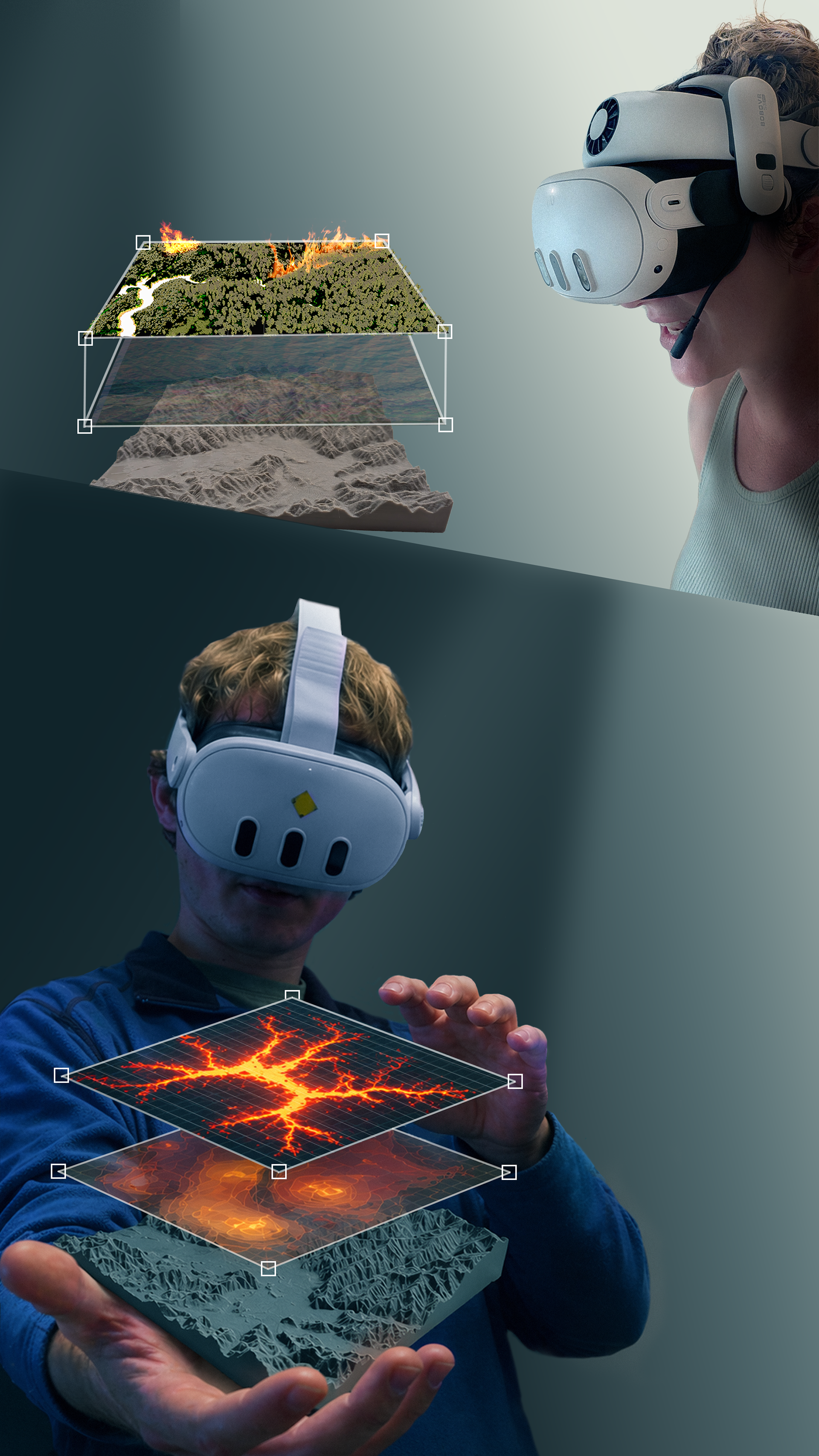
This project brings volcanic hazard modeling into physical space by combining 3D-printed terrain with a real-time lava flow simulation viewed through augmented reality. Working from digital elevation data, I 3D printed scaled landscape models and then adapted the MOLASSES lava flow model into Unity 3D so that simulated flows could be projected directly onto the physical prints.
The simulation runs on a vertex grid built from the same elevation data used to produce the printed terrain, so the digital flow aligns precisely with the model in the user's hands. As the simulation advances, each cell is colored by lava thickness, from thin leading edges to thicker accumulations, while areas without lava stay transparent so only the flow itself is visible. Viewed through a passthrough headset, the result is a flow that appears to move across the tangible landscape in front of the user.
The experience supports additional overlays, including satellite radar imagery, layered onto the same terrain. Rather than reading flow paths on a flat map, users can walk around the model, change their viewpoint, and observe how topography shapes where lava travels. The goal is a multi-sensory way to make volcanic hazard data spatially intuitive and accessible.